Little Powder Watershed
|
The Little Powder River (LPR) originates just North of the City of Gillette, Wyoming and flows into the Powder River near Broadus, Montana. The Little Powder Watershed consists of 1,297,045 acres, with its boundaries extending across Campbell County, Wyoming, Crook County, Wyoming, and Powder River County, Montana. Campbell County, Wyoming contains an estimated 66.7% of the Little Powder Watershed.
The LPR has been classified as a Class 2AB waterway; these waterbodies are protected for agriculture, recreation, drinking water, game fisheries, and other aquatic life. LPR is bounded on the East by the Belle Fourche and Little Missouri River Watersheds and on the West by the Powder River Watershed. Flowing Northward, LPR enters the Powder River several miles Northeast of Broadus, Montana. Surface ownership percentages in the Little Powder Watershed are roughly 3% Bankhead Jones, 9% Bureau of Land Management (BLM), 1% National Grasslands, 78% Private, and 6% State. United States Geological Survey (USGS) data indicates that perennial flow is common on the stream, with only nine no-flow records at the two primary sites monitored within the watershed since 1975. The USGS collected temperature and discharge data at the Little Powder River AB Dry Creek gauge station 06324970, near Weston Wyoming, until 2022. Click here to view the historic conditions at the Little Powder River gauge station. CCCD has since taken over the monitoring of these conditions since the retirement of the gauge. |
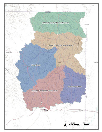
Sub Watersheds within the Little Powder Watershed
|
Water Quality
|
In 2002, LPR was added to Wyoming’s section 303(d) List of threatened waterbodies for primary contact recreation designated use impairment by fecal coliform (WDEQ, Feb. 2016). In 2006, the threatened status was elevated to “impaired” and LPR was added to Wyoming’s section 303(d) List, Table A, Impaired Waterbodies. The impaired segment of LPR extends from the Wyoming/Montana state line upstream to the confluence with Spring Creek. CCCD has monitored water quality and quantity data on LPR at 3 historic sites, at different intervals, since 2002.
E. coli limitations are monitored in all waters designated for primary contact recreation, during the primary recreation season (May 1 through September 30). Concentrations of E.coli bacteria shall not exceed a total of 410 Most Probable Number (MPN) per 100 milliliters. If a sample is taken which exceeds this number, CCCD staff notify the Campbell County Public Health (CCPH) office to recommend against contact with the waterways. Recent monitoring completed by CCCD indicated that bacteria concentrations fluctuated greatly from the 2015 to the 2016 monitoring seasons. The 2015 monitoring seasons received above-average precipitation, while the 2016 monitoring season was much hotter and dryer. The significant hydrological and meteorological variation between the 2015 and 2016 monitoring seasons, make it difficult to determine if water quality improvements were actually achieved. The severe drought conditions in 2016 corresponded to low E.coli concentrations, while the above-average precipitation rates in 2015 corresponded to higher E.coli concentrations. |
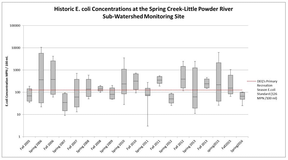
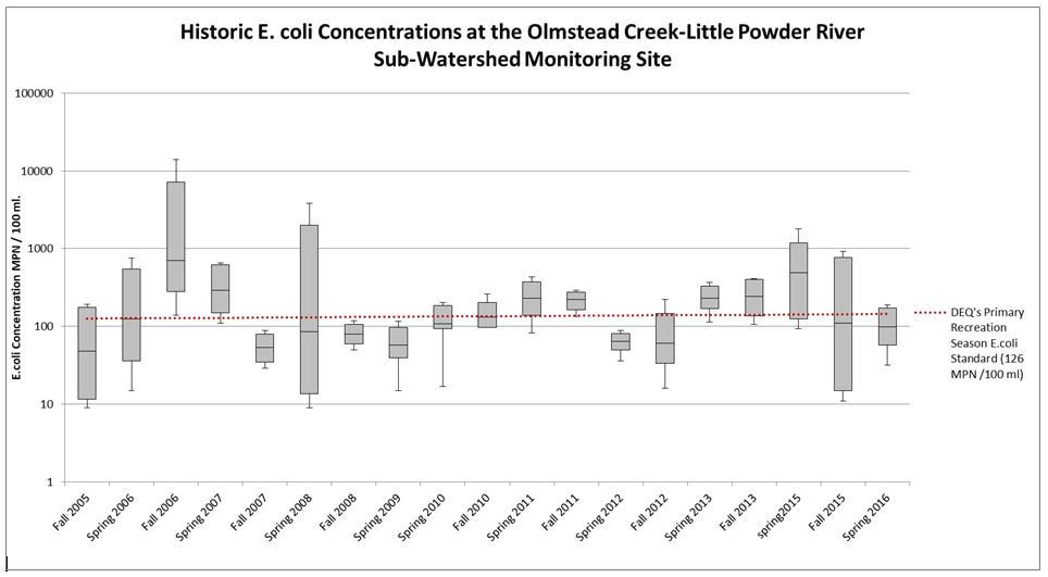
Graphs Showing E. coli Concentrations from 2005 - 2016
|
Projects and Reports
|
Little Powder River Watershed Plan, 2006The Little Powder Watershed Steering Committee addresses concerns with fecal coliform and other water quality standards through a voluntary, landowner-driven planning process. The Committee convened in 2006 to draft and approve the Little Powder Watershed Plan.
|
|
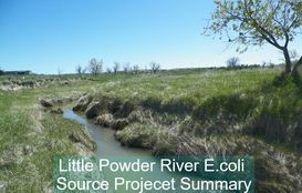
Little Powder River E. coli Source Project, 2015-2016LPR originates just North of the City of Gillette, Wyoming and flows into the Powder River near Broadus, Montana. A section of LPR has been impaired for fecal coliform/E.coli since 2006, with the impaired segment extending from the Wyoming/Montana state line upstream to the confluence with Spring Creek. In 2014, CCCD received Clean Water Act Section 205j Nonpoint Source Pollution Control Funds for surface water monitoring of LPR within Campbell County.
|